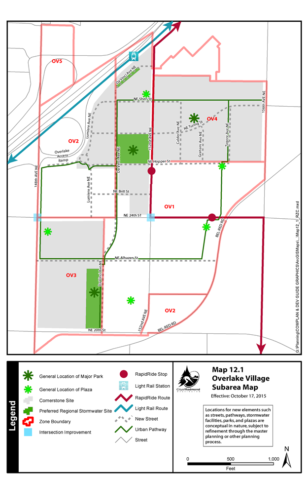
21.12.030 OV Subarea Map.
This section is included in your selections.
A. Preferred land uses and development patterns are designated by five zones, the boundaries of which are delineated on the City’s zoning map and the subarea map below.
B. Locations for new elements, such as streets, pathways, stormwater facilities, parks, and plazas, are conceptual in nature, subject to refinement through the master planning or other planning process.
Map 12.1 |
|---|
|
Note: Online users may click the map for a full-size version in PDF format. |